


loading maps...
- Full screen: Go to Full screen Map Viewer
Interactive Maps
Google Earth:
Web Map:
(The Monthly map is available in Polar » projection)
Other Data Buoy Maps
- NOAA Equivalent Buoy Density Maps »
- Global Drifter Program Array Status »
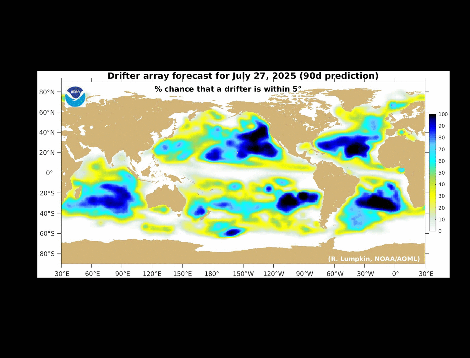
- Global Drifter Program Forecast (90 Day Prediction) »
- Global Archiving Centre (ISDM Canada) »
- ESURFMAR Data availability and index maps »
Observing system maps (GOOS)
- All GOOS Platforms (Floats, Drifters and Moorings) »
- All Sub-surface Profiles »
- All DBCP Platforms (Drifters, Moorings and Fixed Platforms) »
- All GOOS Platforms for the North and South Poles »