
Ocean Observing System
Report Card 2022
GOOS Observations Coordination Group


GOOS Observations Coordination Group
In 2021 key Climate reports underlined the importance of sustained ocean observations and data to support decision-making, protect lives and build sustainable blue economies. As society faces the impacts of climate change, ocean data is vital to better forecast extreme events, such as coastal inundations, cyclones and heatwaves, to support communities facing sea level rise and changes in marine ecosystems on which many depend. This includes projecting potential detrimental impacts on marine ecosystems that are expected in the future through ocean warming, acidification, deoxygenation and other stresses such as overfishing and pollution.
In the latest Global Climate Observing System reports, ocean observing experts have highlighted the need to urgently expand and sustain our Global Ocean Observing System, in order to improve global ocean observations which are fundamental to help monitoring the impacts of long-term climate change, and implementing adaptation and mitigation strategies.
Sabrina Speich
OOPC co-chair and GCOS
Implementation Plan co-author
The Ocean Observing System Report Card 2022 focuses on how an integrated observing system adds value to society across the three Global Ocean Observing System (GOOS) delivery areas of climate, operational services and ocean health, and identifies key gaps in the system. The Report highlights physical, biogeochemical and, for the first time, biological observations, providing a global view of the status of the GOOS.
Over the past year GOOS community worked
hard to restore pre-pandemic levels of in
situ observations. Most activities are slowly
returning to normal and continued automation
is supporting increased data delivery. However,
based on OceanOPS monitoring, a few regions and
networks remain affected and GOOS is catalyzing
discussions to address these needs.
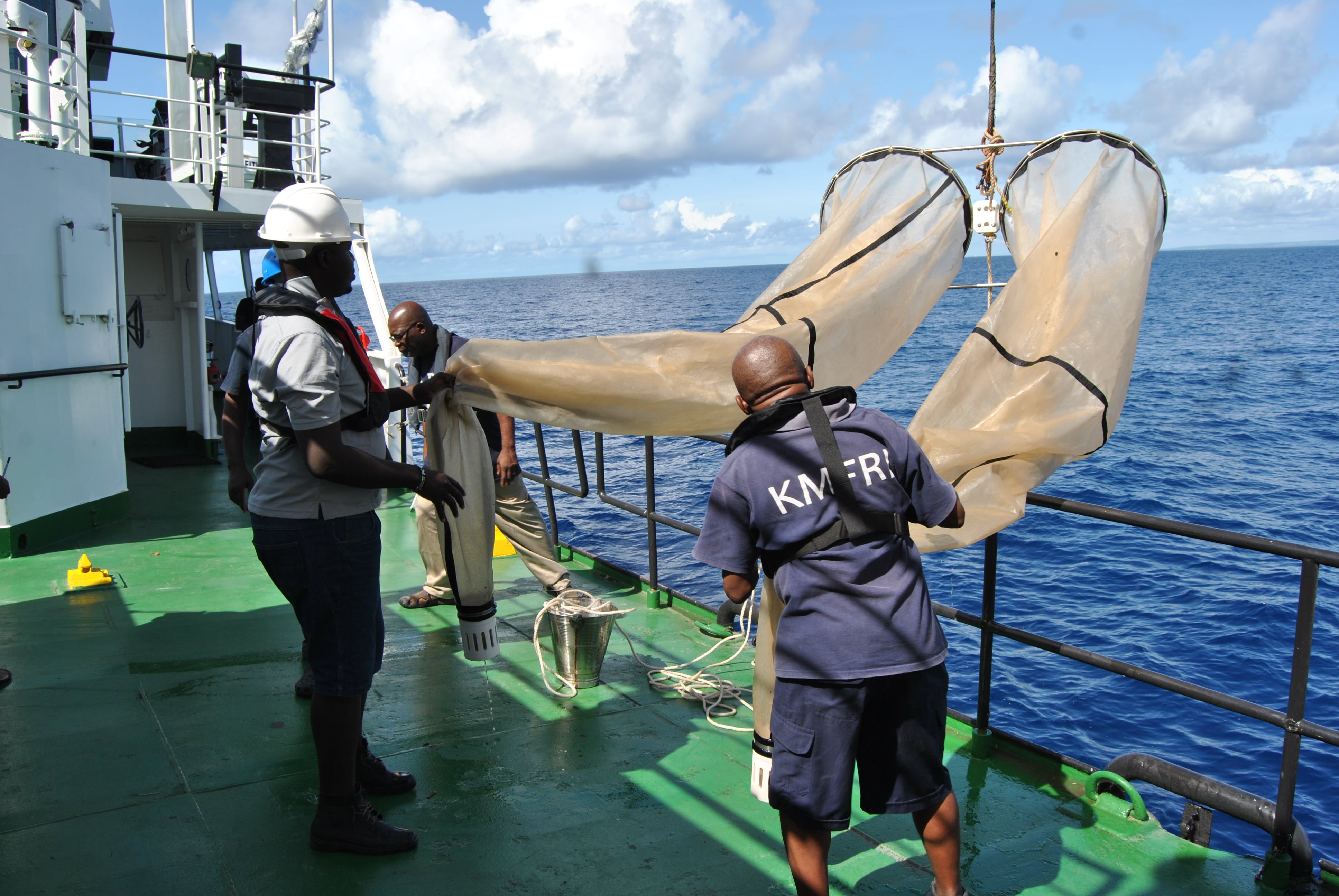
Efficiently delivering critical ocean observations, stretching from high to low latitudes, from the atmosphere to the deep ocean, and from open seas to within Exclusive Economic Zones and coastal waters, across a growing set of physical, biogeochemical and biological variables, remains the fundamental challenge and aim of the observing community.
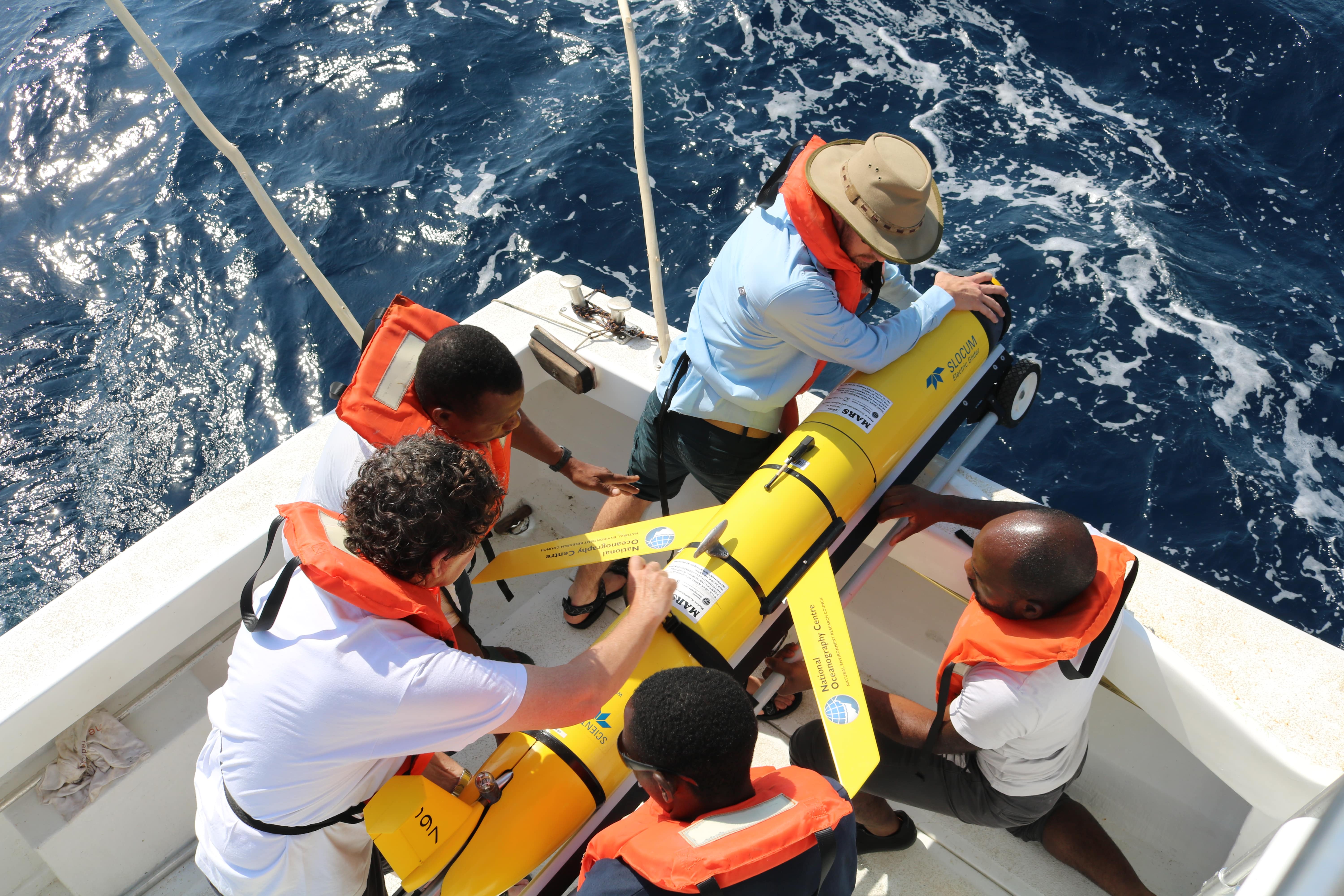
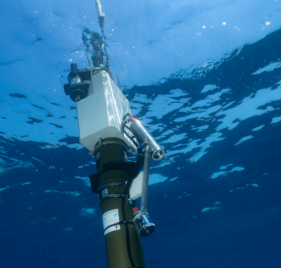
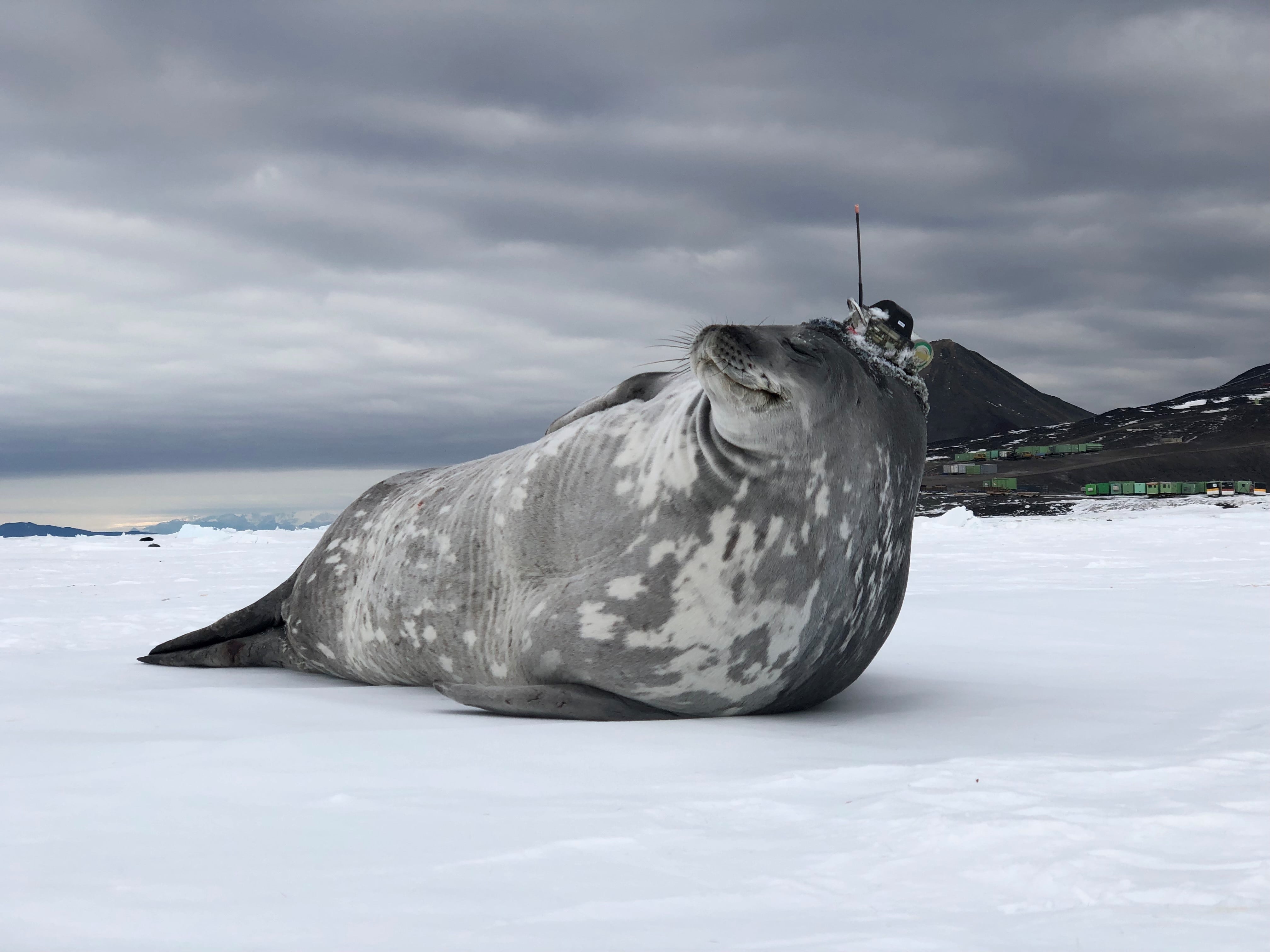
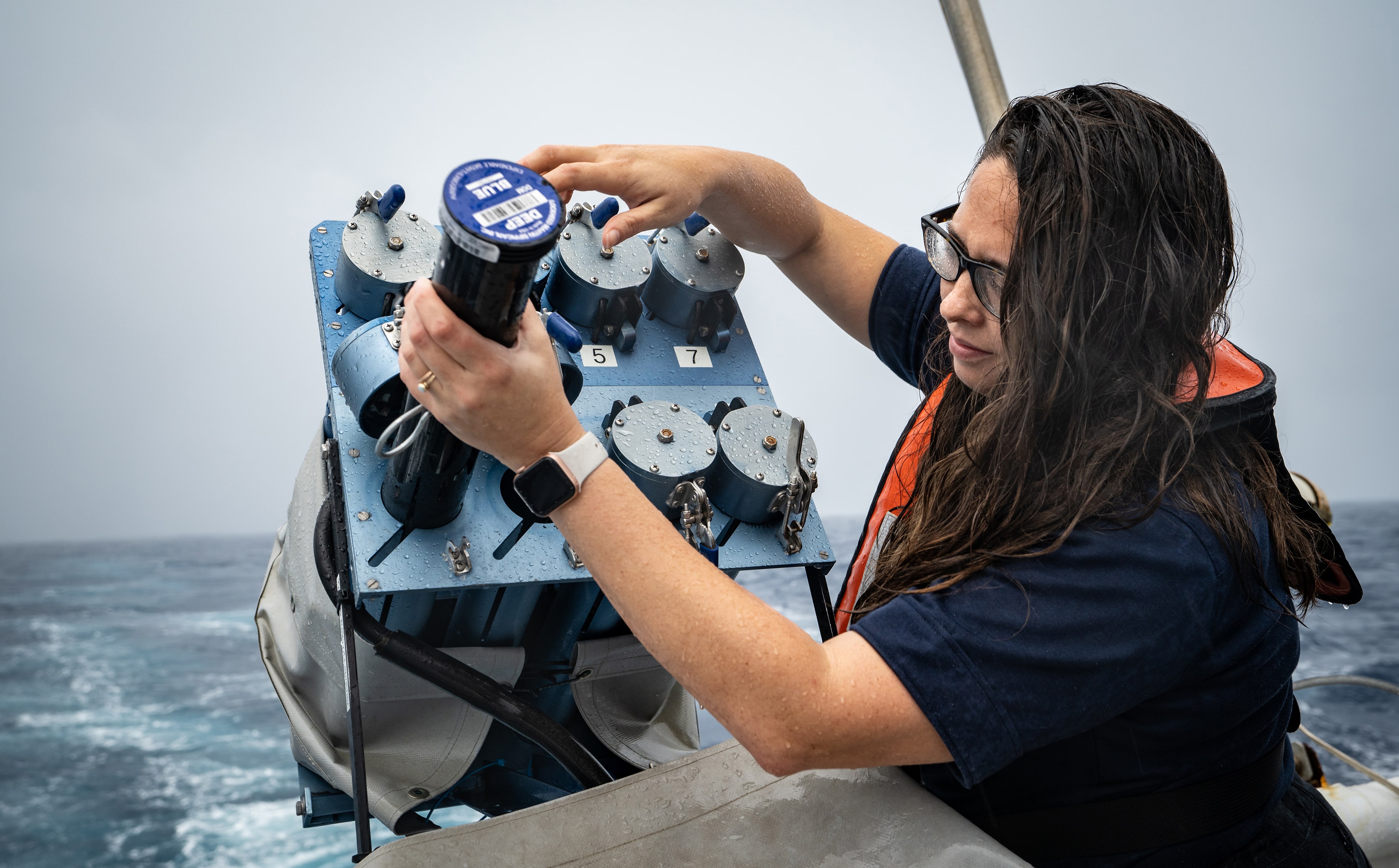
Ship-based multidisciplinary observations, increased use of multi-sensor autonomous platforms, animal borne ocean sensors and instrumented ‘smart’ telecommunications cables represent exciting opportunities to enhance the GOOS.
I hope the ocean observing system will be able to recover from the pandemic, withstand the inflation, and will keep delivering new bioecological and biogeochemical data, observations in the polar ocean, with the full output of the Argo network. International cooperation is the cornerstone for that capacity and IOC, capitalizing on the opportunities offered by the UN Ocean Decade and the 2022 UN Ocean Conference, stands ready to facilitate continuous efforts around ocean observing.
Vladimir Ryabinin
IOC Executive Secretary
This is an interactive map. Click on Details tab in the map menu to discover all functionalities
| GOOS in situ networks1 |
Implementation | Data & metadata | Best practices6 | GOOS delivery areas7 | |||||
|---|---|---|---|---|---|---|---|---|---|
| Status2 | Real time3 |
Archived high quality4 |
Metadata5 | Operational services |
Climate | Ocean Health |
|||
|
|
Ship based meteorological – SOT |  |
 |
||||||
|
|
Ship based oceanographic – SOT | |
|
||||||
|
|
Repeated transects - GO-SHIP |
Not |
|
 |
|||||
|
|
Sea level gauges - GLOSS | |
|
||||||
|
|
Time series sites - OceanSITES |
Not |
|
|
|||||
|
|
Moored buoys – DBCP | |
|
|
|||||
|
|
Tsunami buoys - DBCP | |
|||||||
|
|
HF radars |
Emerging |
|
|
|||||
|
|
Drifting buoys - DBCP | |
|
||||||
|
|
Profiling floats - Argo | |
|
||||||
|
|
Deep & biogeochemistry floats - Argo |
Emerging |
|
|
|
||||
|
|
OceanGliders |
Emerging |
|
|
|
||||
|
|
Animal borne sensors - AniBOS |
Emerging |
|
|
|
||||
Click on network names for links to each network. Click on implementation stars to view related KPIs. More information on networks status & indicators definitions HERE
(1) More information at www.goosocean.org
(2) Status: status of the implementation compared to the community widely adopted target when it exists; network self-assessed status when target doesn’t exist.
(3) Real time: data freely available, without any restriction, on Global Telecommunication System of WMO and internet.
(4) Archived delayed mode: data of the highest quality available for scientific analysis (e.g. climate studies)
(5) Meta-data: information required by OceanOPS
(6) Best Practices: community reviewed and easily accessible documentation encompassing the observations lifecycle
(7) See Network Specification Sheets: www.goosocean.org > Observations > Network Specification Sheets
Of the 40 gigatonnes of carbon emitted to the atmosphere annually by human activities, 48% remains there contributing to global warming, 26% is taken up by the ocean, and the rest by the terrestrial biosphere. The carbon dioxide absorbed by the ocean changes the seawater chemistry through a series of reactions which increases ocean acidity and decreases the concentration of carbonate ions. These changes have severe consequences for marine organisms and ecosystems.
The key societal target of decreasing anthropogenic carbon emissions to the atmosphere needs sound quantification of the oceanic uptake. This uptake varies spatially and temporally, due to differing ocean temperatures, biological processes, and ocean mixing. It is therefore important to monitor ocean carbon chemistry at a wide range of locations and temporal scales, and accurate quantification of the annual air-sea exchange is necessary to capture this critical element of the global carbon cycle.
Collecting ocean carbon data, capturing and modeling intertwined physical, biogeochemical and biological processes, is the only way to allow more accurate model projections contributing to IPCC climate trajectories, and thus helping to design decarbonization policies and to predict how ocean carbon uptake will evolve over time.
WMO is seeking to establish a Global Greenhouse Gas Monitoring System, strengthening the international observing infrastructure and related modeling and assimilation efforts. This will help improve our understanding of the carbon cycle, reduce uncertainties about greenhouse gas sources and sinks, thus supporting Paris Agreement mitigation action.
Lars Peter Riishojgaard
WMO Integrated Global Observing System Director
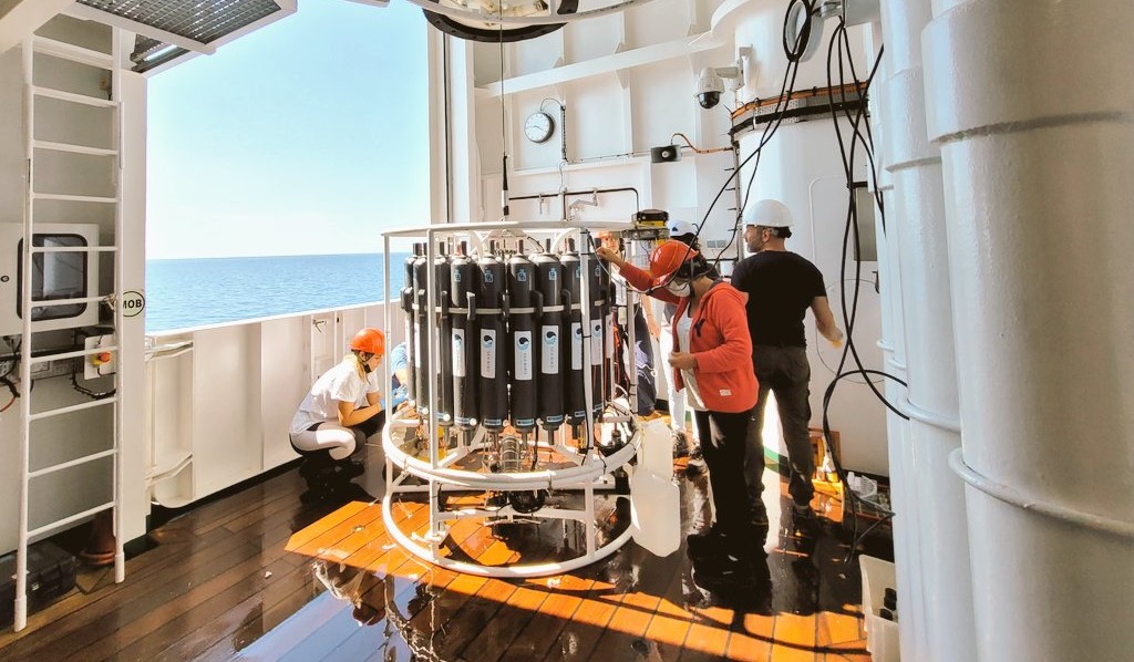
Surface ocean carbon data are currently obtained using ships and fixed, drifting and autonomous platforms. An annual quality-controlled data synthesis is provided by the Surface Ocean Carbon Atlas (SOCAT), which is utilized by scientists to estimate the ocean carbon uptake and its variation.
Additionally, robust quantification of the ocean carbon sink requires observations throughout the water column, and augmenting the oceanatmosphere flux information that can be determined from surface ocean measurements.
Biogeochemical ocean data from repeat hydrography cruises measurements of water samples are quality controlled and synthesized under the Global Ocean Data Analysis Project (GLODAP). Information from autonomous floats profiling the ocean interior and ships gradually adds value to our understanding of the ocean carbon cycle.
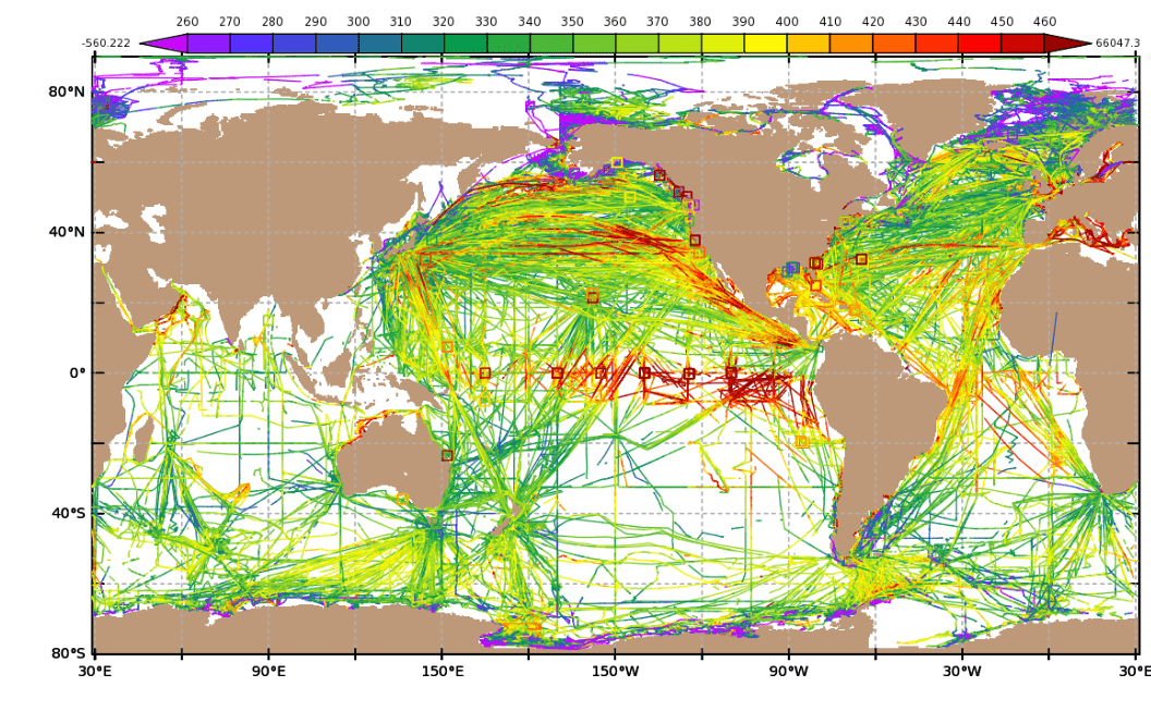
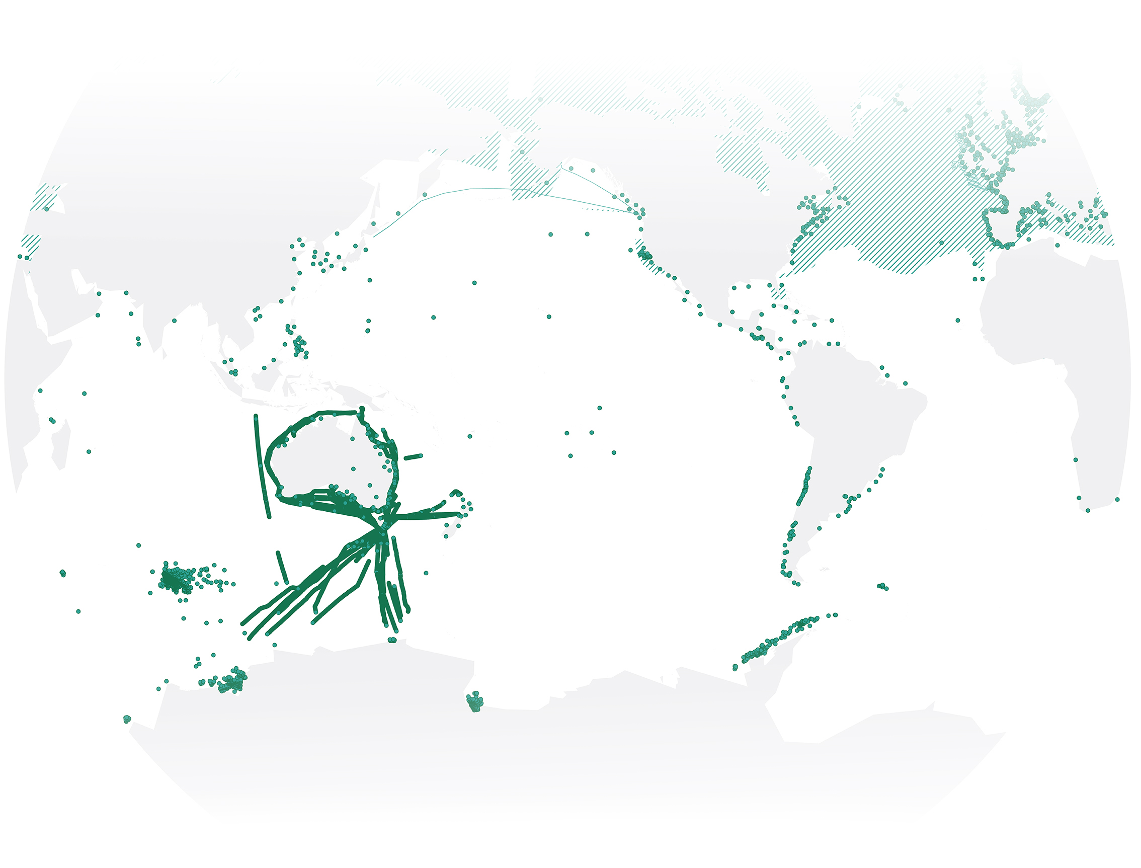
In situ surface ocean fCO2 values (colour coded, μatm) with an accuracy of < 5 μatm in version 2021. Squares indicate moorings. Data source: www.socat.info
GOOS has developed the capability to observe some aspects of global carbon, and the number of ocean carbon observations is growing. However, the overall ocean carbon observing system is extremely inadequate and immature to meet the growing and urgent need for ocean carbon information. To address these needs, GOOS requires investment in the following areas:
Coastal zones and communities are increasingly at risk from rising sea levels and more frequent and intense storm surges which can cause coastal inundation and flooding, posing danger to people and property, and financial strain on governments.
With high-tide flooding events expected to increase in the next 30 years, with combined effects of rising sea-levels, extreme climate events, and the moon’s gravitational pull, delineating regions of flooding or future flood vulnerability requires urgent monitoring over broad areas to provide timely forecasts and life-saving early warning services.
Severine Fournier
NASA Jet Propulsion Laboratory Scientist
GOOS observations are essential contributions to advance weather and flood warnings. Several thousand vessels provide ship-based meteorological observations, and a small number of ships launch radiosonde balloons to measure upper air atmospheric variables (e.g. pressure, temperature, humidity and winds), crucial for obtaining information on pressure systems which affect sea level and wave conditions. In addition, wave measurements from coastal national moored buoys, and observations of sea level from tide gauges are needed to capture sea level extremes.
Complementary to in situ measurements, remote sensing optical and microwave sensors provide valuable information, such as flood extent, progression, and recovery, on land and over large spatial scales. Such remote sensing observations are also used to quickly identify areas that require aid after flooding events.
Observations of sea level are one of the sets of repeated Essential Climate Variables measured by satellites for generating a wide range of forecasts and enabling early warning systems.
Between 2009 and 2019 the Coastal Inundation Forecasting Demonstration Project, developed by the World Meteorological Organization (WMO), was successfully implemented in 4 countries – Bangladesh, Fiji, Dominican Republic (plus Haiti), and Indonesia. The implementation of coastal inundation early warning systems in these countries enables their meteorological and hydrological services to provide better guidance with enough lead-time to coastal communities, especially those vulnerable to hazards such as storm surges and damaging swell waves leading to coastal inundation.
Several wave buoys were deployed on the south coast of Fiji enhancing forecasts and warnings of coastal inundation. The Fiji Minister for Infrastructure, Disaster Management, Land and Mineral Resources and Meteorological Services declared that work done by the Fiji Meteorological Service had enabled better planning and sound decisions prior to and during the advent of severe tropical cyclone Harold in April 2020.
Close to Fiji, communities in Tuvalu, an atoll nation part of the small island developing state and characterized by an average land elevation of 2.20 meters above mean sea level, are increasingly vulnerable to coastal inundation hazards. Currently, the Tuvalu Meteorological Services (TMS) is being supported to develop high-resolution offshore wave, sea-level, inundation forecasts and tide predictions. In addition, a wave buoy was successfully deployed in Tuvalu providing real-time observations that are key to TMS’s forecast and warning services.
In addition to the establishment of early warning systems for countries local needs and encouragement in using locally deployed buoys, WMO has released awareness videos for the Pacific Islands and Caribbean regions to highlight the importance of observations provided by wave buoys and to discourage buoy vandalism.
Tuvalu Meteorological Services have a tide gauge which provides sea level conditions in the lagoon. The recent deployment of the wave buoy, will really assist the meteorological office in comparing and validating their forecasts with the conditions offshore.
Tavau Simeona
TMS Forecast Scientific Officer
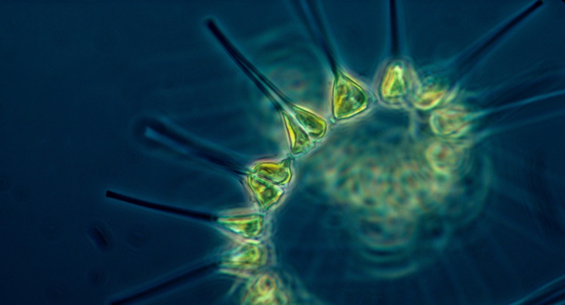
Marine phytoplankton are microscopic organisms that live in the upper ocean and contribute to more than 45% of the total amount of biological organic matter produced in the ocean. Phytoplankton form the base of marine food webs, supporting other forms of life, including commercial fish valued at ~US$401 billion/year. They supply oxygen and move chemicals such as carbon, nitrogen and phosphorus from one form to another. Some phytoplankton can form harmful algal blooms and can be detrimental to the environment, living resources, and humans.
Rising ocean temperatures and acidification are impacting phytoplankton. Ocean warming is slowing the mixing of deeper waters with shallower waters that supplies nutrients from deeper waters to the upper ocean, decreasing the production of phytoplankton. This also reduces the amount of carbon stored within phytoplankton that sinks into deeper waters when phytoplankton die. Ocean acidification can also affect phytoplankton such as coccolithophores, a group of species that builds shells sensitive to changing ocean acidity.
Measurements of ocean surface color collected using cameras and space-based lasers on satellites, airplanes, and drones, provides estimates of global phytoplankton abundance. Combined, these technologies provide information on phytoplankton distribution in the upper layers of the ocean at all times of the day and through the year. Because of the importance of these measurements to understand global change, ocean color is both an Essential Ocean and Climate Variable.
Complementary to satellite measurements, bio-optical sensors, nets, and discrete water sampling provide in situ information about the composition of species of phytoplankton, the pigments they contain, and their distribution. To date, biogeochemical profiling floats have acquired over 100,000 profiles from which phytoplankton biomass has been estimated across the global ocean. New methods are being advanced, to better understand links between ocean biodiversity and ecosystem services, such as global oxygen production.
An exciting development is the integration of novel methods for measuring phytoplankton and other biological variables during global ocean repeat hydrographic surveys.
Modeling phytoplankton diversity, abundance, and biomass is fundamental to understanding how food and carbon storage will change in the ocean. Current model projections disagree substantially when estimating phytoplankton biomass and productivity in the global ocean. This is because of limitations in our knowledge of phytoplankton ecology, including their diversity, species interactions, seasonal cycles, and how they incorporate and utilize different chemicals including carbon. Not all species are equal in regards to carbon content, its export to deeper water layers, and harmful or beneficial impacts including nutrition for other forms of life.
An important goal of GOOS is to improve forecasting of the ecosystem services provided by phytoplankton that support the Blue Economy, and this can only be achieved through gathering continued global phytoplankton observations.
We need to move beyond simple estimates of the amount of carbon or pigments contained in these microorganisms if we want to understand the drivers and pressures leading to shifts in marine life.
On-going effort by the GOOS Biology and Ecosystems panel to identify
biological observing programs measuring the phytoplankton in the global
ocean. Data source: bioeco.goosocean.org
Contact: helpdesk@obis.org to add your program to this map.
The involvement of new communities - citizens, sailors, divers, and businesses - in ocean observations is an important way we can connect people with the ocean and get more ocean data, contributing to the implementation of the GOOS.
Odyssey, launched by OceanOPS, and endorsed as a project under the UN Decade of Ocean Science for Sustainable Development, intends to take a big step forward channeling the energy of civil society to support ocean observations.
Many initiatives are being developed to generalize meteorological and oceanographic observations from merchant ships, fishing fleets, sailors, and other ship users from the coast to the open ocean, but they are fragmented and have not yet unleashed their full potential.
Mathieu Belbéoch
OceanOPS Manager
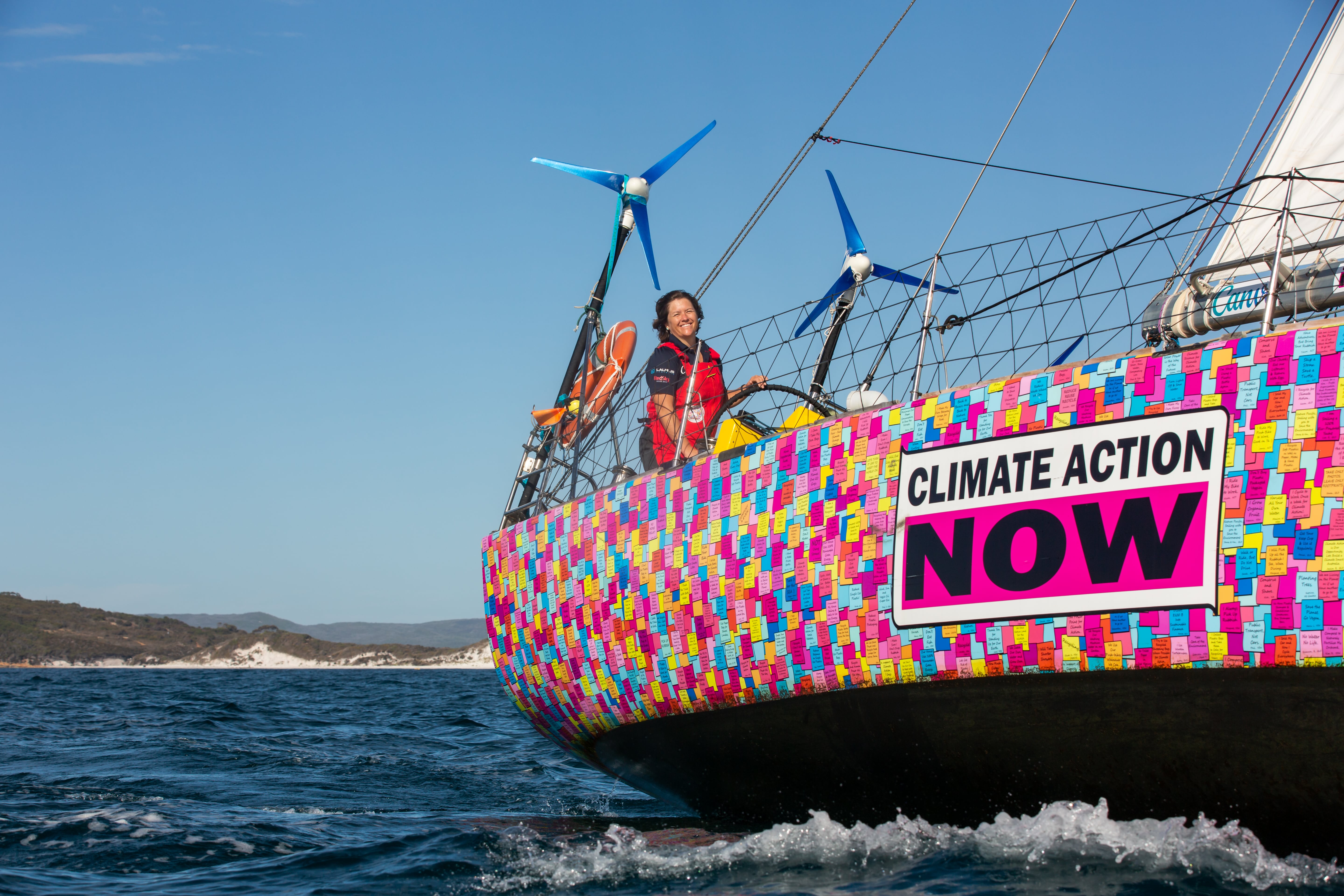
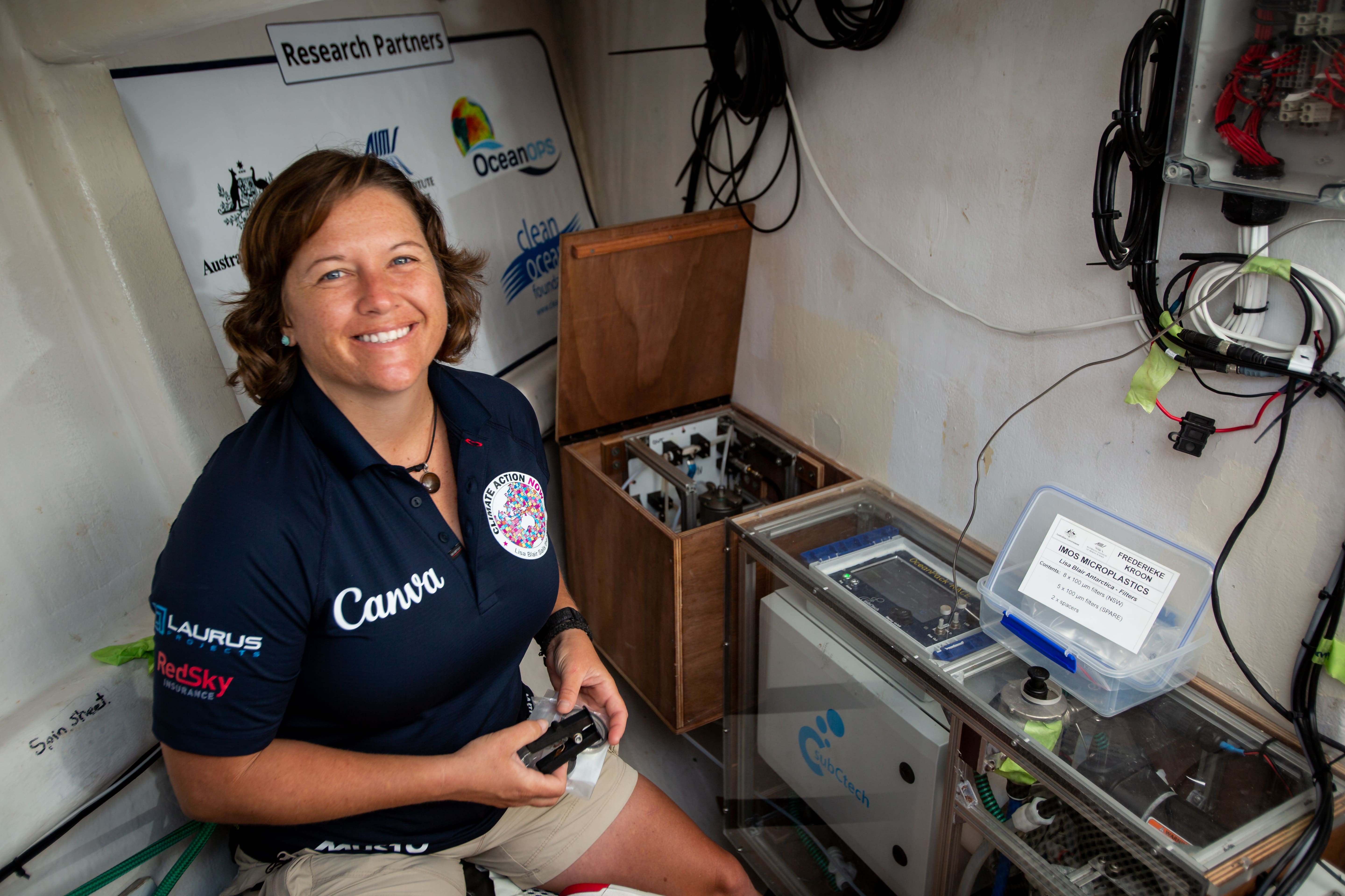
Several commercial shipping, ferry and tourism companies, non-governmental organizations, and sailors have already expressed their engagement within Odyssey. One great example is sailor Lisa Blair who just broke the single-handed non stop around Antarctica record. She used this opportunity to raise awareness of her Climate Action Now campaign, collect oceanographic and atmospheric observations, and deploy a dozen autonomous drifting buoys and profiling floats in an under-sampled region.
“The science aspect of this trip is one of the most important factors for me. To be able to collect scientific data from a region of our planet where we have none, makes this trip worth every early morning sample change”, writes Lisa in her blog, getting up from the sleeping bag to do microplastic sample changes, after 5 hours of sleep on a cold polar night.
Indonesia is a country of more than 17,000 islands with a coastline of more than 108,000 km and the world’s richest marine biodiversity. The country’s ambitions to develop and secure its maritime economy will lead to the deployment of an unprecedented marine meteorological and oceanographic observing system and forecasting capability. About 200 observing instruments - including tide gauges, HF radars, automatic weather stations, drifting buoys, floats and gliders - will be deployed during 2021-2025, supporting the development of ocean science and technology in the region, as well as its contribution to the GOOS.
In addition, the Agency for Meteorology, Climatology and Geophysics of the Republic of Indonesia (BMKG) established the Fisherman’s Weather Field-School to work closely with the traditional fishery and aquaculture sectors to increase their understanding and use of weather and climate information. While Indonesian fisheries are of global importance, local fishermen regularly face dangers at work, which often result in accidents and even fatalities due to severe weather conditions at sea. But having ocean information as well as the ability to apply it can help reduce risky situations and save lives.
Thanks to the knowledge gained through the Fisherman’s Weather Field School, Mansur Dokeng, a local fisherman from Kupang, was able to save his family and the whole village from the deadly Seroja cyclone in April 2021.
Nelly Florida Riama
BMKG Director of Education and Training Center
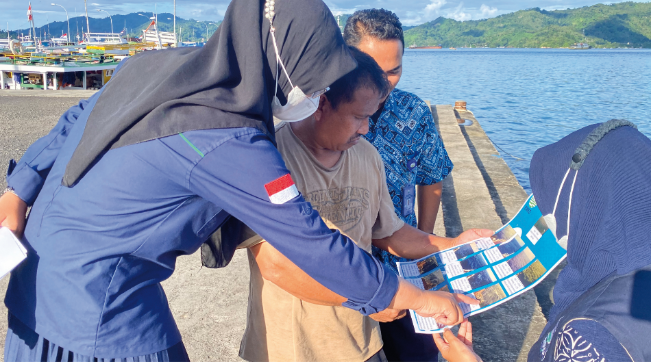
The project, which is part of the GOOS Observing Together Programme, aims to bridge the gap between technology innovation and user capacity in local fishing communities, improving ocean literacy and enabling fishermen to use weather information in their daily activities. As end-users of ocean observing data, these fishermen also play an important role in assessing it and providing feedback that allows Indonesia to improve the observing system’s fitness for purpose.
Ocean observing is the base of much of the exciting work the UN Decade of Ocean Science for Sustainable Development will carry out to better manage the ocean and ensure a sustainable future. To transform our ocean observing system, GOOS has launched 3 Ocean Decade programmes:
Observing Together will transform our ocean observing system assessment and design processes by creating a system co-designed with observing, modeling and key user stakeholders.
Ocean Observing Co-Design will improve ocean data access and availability by connecting ocean observers and the communities they serve.
CoastPredict will revolutionize Global Coastal Ocean observing and forecasting by co-designing the needed infrastructure and offering open and free access to coastal information.
Enhanced ocean observations will form the foundation for thriving blue economies and sustainable development. Together these GOOS Programmes will provide essential support needed to give us the ocean we need for the future we want.
Emma Heslop
GOOS Acting Director
The long-term impacts of the pandemic on the global ocean observing system are concerning, as are the unforeseen market changes leading to increased costs. Resultantly, there are several gaps in our ocean buoy, float and ship-based observations that must be addressed. Despite these challenges, the need for observation-based knowledge has never been stronger, as noted in the recent IPCC and GCOS reports.
GOOS stakeholders are already responding to these needs through new in situ and satellite capabilities. More importantly, increased cooperation (e.g. through co-design processes) between observers, modelers, and communities who can realize value from ocean observations, is on the rise and is the focus of multiple new actions under the UN Decade of Ocean Science.
Continued and new targeted investment in ocean observing is vital to ensure we characterize how our ocean is changing, what changes are likely in the future, and how we can mitigate and adapt to our changing earth system.
David Legler
GOOS Observations Coordination Group Chair
We thank all funders for their support, and the observing system implementers for their remarkable
work in recovering and continued progress in developing our global ocean observing system!
If you wish to contribute to the global ocean observing
system, please contact:
OceanOPS, GOOS Observations Coordination Group, GOOS-BGC and BioEco Panels, OOPC Panel, WMO and IOC/UNESCO Secretariats
GOOS Report No.274
Conception graphique : hippocampe.com • 07/2022 • © M. Palmer/National Oceanography
Centre, UK; NOAA, Solstice-WIO; C.Ridgeway; S. Tavau; Pixabay; SLCN;
P.Castagno/Parthenope University (PNRA); D.Luquet/IMEV; R.Harcourt; NOAA Ocean
Exploration; A.E.R. Hassoun/GEOMAR